Topographic & Contour Surveys
Precise terrain mapping for infrastructure planning, road design, and DPR preparation
Comprehensive Terrain Mapping
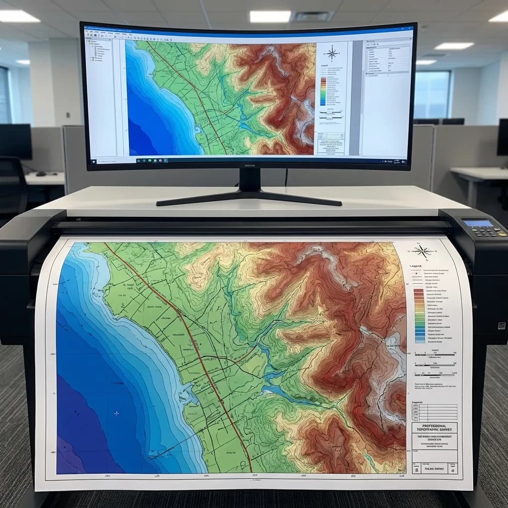
Topographic surveys form the foundation of any infrastructure project. Our surveys provide accurate ground surface data with contour lines, spot elevations, and existing features mapped to scale.
Whether you're planning a road alignment, drainage system, or building sites, our topographic data gives you the accurate base map needed to design with confidence.
Our surveys include:
- Ground surface elevations
- Contour lines at required intervals
- Existing structures and features
- Boundary delineation
Key Applications
Where Topographic Surveys are Essential
Road Alignment Design
Accurate terrain data for alignment design, vertical and horizontal profiling, and earthwork estimations.
Drainage System Planning
Contour mapping for natural drainage patterns, watershed analysis, and drainage structure placement.
Building Site Planning
Site grading plans, foundation levels, and earthwork volume estimations for construction projects.
Canal & Embankment Surveys
Cross-section surveys for canal renovation, embankment strengthening, and capacity analysis.
DPR Preparation
Complete survey data packages for Detailed Project Reports, including plans, profiles, and cross-sections.
Land Development
Topographic base maps for residential layouts, industrial plots, and township planning.
Equipment We Use
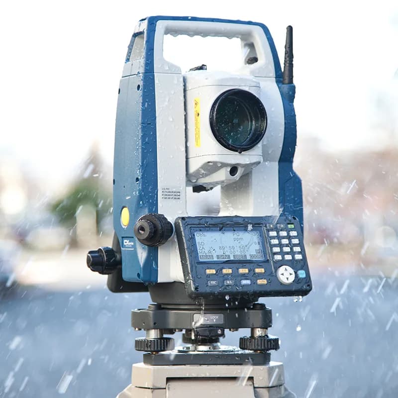
SOKKIA CX-105 Total Station
- • 5" angle accuracy
- • 500m reflectorless range
- • 5,000m prism range
- • IP66 rated for field conditions

ESurvey CADD Software
- • Traverse processing & adjustment
- • Contour generation & smoothing
- • DTM creation & analysis
- • CAD export (DWG, DXF)
What You Receive
- Digital Terrain Model (DTM)
- Contour map at specified intervals
- Spot elevation points
- Mapped existing features to scale
- CAD files (DWG, DXF formats)
- PDF plots for printing
- Survey report with methodology
- Raw survey data on request
Need a Topographic Survey?
Get accurate terrain data for your project. Contact us for a free consultation and detailed quote.